Top Stories
Storm Floris Hits Ireland with Gale-Force Winds and Heavy Rain

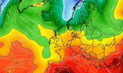
Ireland is preparing for severe weather as Storm Floris approaches overnight, bringing strong winds and heavy rain. The national forecaster, Met Eireann, has issued several Status Yellow weather warnings for multiple counties, indicating the potential for significant disruptions.
The storm is expected to affect the west and north of the country most severely. A Status Yellow wind warning is in place for Clare, Galway, Mayo, and Sligo, with damaging gusts anticipated. This warning will be active from 2:00 AM to 1:00 PM on March 4, 2024. During this time, hazardous conditions could lead to dangerous travel, disruption of outdoor events, and potential structural damage. There is also a risk of fallen trees, debris, and power outages.
In addition to wind warnings, a separate Status Yellow rain warning has been issued for Donegal, Galway, Leitrim, Mayo, and Sligo. This alert will be in effect from 2:00 AM until 10:00 AM, with heavy rain expected, along with possible thunderstorms. Local flooding and lightning strikes are also concerns.
Another wind warning applies to Cavan, Donegal, Monaghan, and Leitrim, valid from 4:00 AM until 4:00 PM on the same day. Met Eireann warns these areas will experience very strong and blustery winds, likely leading to similar impacts as those forecasted for the earlier warnings.
The UK Met Office has also issued a Status Yellow wind warning for Antrim, Armagh, Down, Fermanagh, Tyrone, and Derry, set to begin at 6:00 AM and last until 11:59 PM on March 4.
The day will start off wet and windy, but conditions are expected to improve by lunchtime. A forecaster from Met Eireann stated, “Tonight, Storm Floris will track to the northwest of Ireland bringing unseasonably wet and windy weather with spells of rain, heavy at times in the north and northwest with some spot flooding possible.”
Temperatures during this period are anticipated to remain between 11°C and 16°C, with winds increasing to near gale force along the Atlantic coasts by morning. Bank Holiday Monday will begin with strong southwest to west winds, but the rain is predicted to clear eastwards through the morning, giving way to sunny spells and scattered showers later in the day.
As the storm passes, winds are expected to ease, with maximum temperatures ranging from 16°C to 21°C. Areas in the north and northwest may feel cooler, but overall, conditions should stabilize as the storm moves away from Ireland.

Athenry Event Honors Liam Mellows on 103rd Anniversary Tomorrow

Major Changes to Rural Social Scheme Announced by Galway Officials

Gavin McAteer Joins “Teddy Murphy” at Letterkenny Sports Assembly

Tragedy and Celebration: Key Events Shaping the Weekend News

Ireland’s RTÉ Takes Bold Stand Against Eurovision Amid Political Turmoil

Russian Drone Strikes Hit Ukrainian Energy Infrastructure, Causing Blackouts

WPP Media Unveils ‘Dependency Dilemma’ in Irish Language Ads

Bath Aims to Kick Off European Campaign Strong Against Munster

Urgent Water Supply Disruptions in Carrigart and Clonmany Today

Tributes Surge for 9-Year-Old Leon Briody After Cancer Battle

Aimee Osbourne Joins Family for Emotional Tribute to Ozzy

Danny Healy-Rae Considers Complaint After Altercation with Garda

Ireland Enjoys Summer Heat as Hurricane Erin Approaches Atlantic
Hawaii Commemorates 80 Years Since Hiroshima Bombing with Ceremony

Newcastle West Woman Patricia Foley Found Safe After Urgent Search

Fianna Fáil TDs Urgently Consider Maire Geoghegan-Quinn for Presidency

Couple Convicted of Murdering Two-Year-Old Grandson in Wales

Gaza Aid Distribution Tragedy: 20 Killed Amid Ongoing Violence
-
 Top Stories3 months ago
Tributes Surge for 9-Year-Old Leon Briody After Cancer Battle
-
 Entertainment4 months ago
Aimee Osbourne Joins Family for Emotional Tribute to Ozzy
-
 Politics4 months ago
Danny Healy-Rae Considers Complaint After Altercation with Garda
-
 Top Stories4 months ago
Ireland Enjoys Summer Heat as Hurricane Erin Approaches Atlantic
-

 World5 months ago
Hawaii Commemorates 80 Years Since Hiroshima Bombing with Ceremony
-
 Top Stories3 months ago
Newcastle West Woman Patricia Foley Found Safe After Urgent Search
-
 Top Stories5 months ago
Fianna Fáil TDs Urgently Consider Maire Geoghegan-Quinn for Presidency
-
 World5 months ago
Couple Convicted of Murdering Two-Year-Old Grandson in Wales
-
 World5 months ago
Gaza Aid Distribution Tragedy: 20 Killed Amid Ongoing Violence
-

 World5 months ago
Aristocrat Constance Marten and Partner Convicted of Infant Murder
-

 Top Stories4 months ago
Climbing Errigal: A Must-Do Summer Adventure in Donegal
-

 Top Stories4 months ago
Hike Donegal’s Errigal Mountain NOW for Unforgettable Summer Views