World
Hurricane Erin Approaches US East Coast, Evacuations Ordered
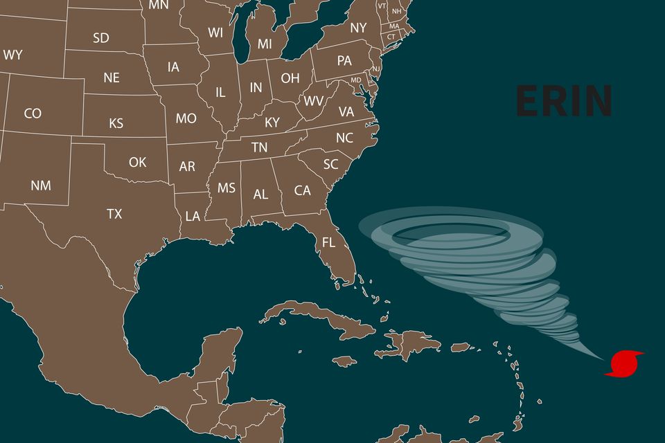
Hurricane Erin is steadily moving towards the eastern coast of the United States, prompting evacuations and raising concerns about dangerous surf conditions. As the storm approaches, forecasters are issuing warnings about rip currents and high waves, which have already necessitated numerous beach rescues along the coast. While the storm’s center is expected to remain offshore, its outer bands are likely to bring tropical-force winds and hazardous conditions to several regions.
Waves exceeding three metres are anticipated off the coast of Massachusetts, with local authorities taking precautions to ensure public safety. In New Jersey, several beaches are closing to swimming in response to the worsening conditions. “Enjoy the shore, enjoy this beautiful weather, but stay out of the water,” stated New Jersey Governor Phil Murphy as officials brace for the storm’s impact.
As Erin churns through the Caribbean, it has expanded significantly, with its tropical storm winds now reaching up to 320 kilometers from the core. Currently classified as a Category 2 hurricane, Erin has maximum sustained winds of 170 kilometers per hour, according to the National Hurricane Centre in Miami. By September 25, the storm was located approximately 1,050 kilometers southwest of Bermuda and continues to affect the Turks and Caicos Islands, where government services have been suspended and residents ordered to remain indoors.
Evacuations and Safety Measures in Place
In North Carolina, particularly along the barrier islands of the Outer Banks, local leaders have expressed concern about Erin’s potential to cause significant storm surges. Waves could reach heights of 4.6 meters, leading to flooded roads and dangerous conditions. Mandatory evacuations have been instituted on Hatteras and Ocracoke Islands, with more than 1,800 residents evacuated by ferry since Monday.
Rip currents have already posed a danger to swimmers, with at least 60 rescues reported on Monday at Wrightsville Beach, near Wilmington, North Carolina. The largest swells along the east coast are expected to develop today and persist into tomorrow, further exacerbating the perilous conditions.
Climate scientists have noted a troubling trend: Atlantic hurricanes are becoming increasingly likely to rapidly intensify. This phenomenon is fueled by warmer ocean temperatures, which can lead to the formation of powerful storms. Just two years ago, Hurricane Lee similarly intensified unexpectedly, resulting in severe storms and rip currents along the eastern seaboard.
As Hurricane Erin continues its path through the Atlantic, residents along the US east coast are urged to remain vigilant. Local authorities are prioritizing public safety and are prepared for potential impacts as the storm approaches.

Carlow Launches €8 Million Innovation Hub to Boost Local Economy

Nikita Hand Announces Pregnancy Amid Ongoing Legal Battles

Late Late Toy Show Celebrates 50 Years with Star-Studded Spectacle

Glenswilly National School Sports Pitch Planning Approved NOW

Galway Medtech Triumphs at 2025 Irish Medtech Awards

Urgent Warning: Common Cold Medication May Worsen Symptoms

Tragic Death Raises Concerns Over Freebirthing Practices

John Lewis Praises Co Tyrone School’s Heartwarming Christmas Video

Russia Launches Extensive Drone and Missile Assault on Ukraine

Tributes Surge for 9-Year-Old Leon Briody After Cancer Battle

Aimee Osbourne Joins Family for Emotional Tribute to Ozzy

Danny Healy-Rae Considers Complaint After Altercation with Garda

Ireland Enjoys Summer Heat as Hurricane Erin Approaches Atlantic
Hawaii Commemorates 80 Years Since Hiroshima Bombing with Ceremony

Newcastle West Woman Patricia Foley Found Safe After Urgent Search

Fianna Fáil TDs Urgently Consider Maire Geoghegan-Quinn for Presidency

Couple Convicted of Murdering Two-Year-Old Grandson in Wales

Gaza Aid Distribution Tragedy: 20 Killed Amid Ongoing Violence
-
 Top Stories3 months ago
Tributes Surge for 9-Year-Old Leon Briody After Cancer Battle
-
 Entertainment4 months ago
Aimee Osbourne Joins Family for Emotional Tribute to Ozzy
-
 Politics4 months ago
Danny Healy-Rae Considers Complaint After Altercation with Garda
-
 Top Stories4 months ago
Ireland Enjoys Summer Heat as Hurricane Erin Approaches Atlantic
-

 World5 months ago
Hawaii Commemorates 80 Years Since Hiroshima Bombing with Ceremony
-
 Top Stories3 months ago
Newcastle West Woman Patricia Foley Found Safe After Urgent Search
-
 Top Stories5 months ago
Fianna Fáil TDs Urgently Consider Maire Geoghegan-Quinn for Presidency
-
 World5 months ago
Couple Convicted of Murdering Two-Year-Old Grandson in Wales
-
 World5 months ago
Gaza Aid Distribution Tragedy: 20 Killed Amid Ongoing Violence
-

 World5 months ago
Aristocrat Constance Marten and Partner Convicted of Infant Murder
-

 Top Stories4 months ago
Climbing Errigal: A Must-Do Summer Adventure in Donegal
-

 Top Stories4 months ago
Hike Donegal’s Errigal Mountain NOW for Unforgettable Summer Views